

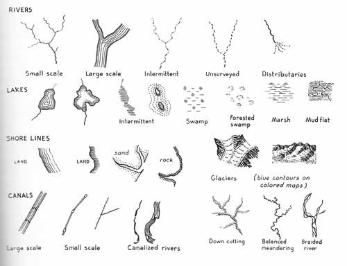
Map symbols for water features will differ because of scale and detail wanted. Small scale maps are maps that cover a large area and don't show a lot of detail about the landscape.
The important thing is to make the symbols similar over the map for consistency. If you were to use the large scale river with the shore line land below on the same map it could confuse the viewer. Make symbols clearly contrast.
Here are some symbols from his book Principles of Cartography published in 1932.
...
If hand-drawing a map, you typically draw shorelines and rivers first because they help locate cities, mountains, and other features.
Increase line thickness of rivers as you proceed downstream to represent the widening of the channel. Don't show every meander and detail. Simplify. But do show dams.
Click here to read more decorative map articles.